Head office location:
Bulgaria
Elhovo
Headoffice address:
8, Targovska Str., floor 2, Elhovo, Bulgaria
Phones: +359 877777960;
+359 885841230;
+359 887762939
sales@bulgarianestates.org

Town / Village: Goliamo Krushevo
Yard: 1500.00 sq. m.
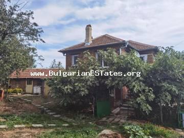
Living area: 140.00 sq. m.
The village of Goliamo Krushevo is situated in the south-eastern part of Bulgaria, municipality of Boliarovo. The village is located in the north-western part of the Strandja Mountain. The village is located 35 km in the east from the town of Elhovo; 60 km in the south-west of Black Sea / town of Bourgas/ and 20 km from the Turkish border.
The village is sheltered between two elevations, division of rural river ' Kushu dere ' of two quarters. The village sea-level is of 315,5 meters. The village of Goliamo Krushevo is surrounded in the north with the ' Bakadjitsite' hills, in the west - the Manastirskite and Svetiiliiskite eminences, away Stara Mauntains, the south - of ' Saruluka ' , ' Rosenskia bair ' , to the east - ' Eki-tepe ' and of ' Kara-tepe '.
The surface is hilly. The highest summit in the land is ' Sara- lakut ' - 486 meters. The climate is with is soft in winter and a fresh - in summer. Booth the Black sea and the Aegean sea has influenced on the climate.
The territory of the village of Goliamo Krushevo, consists of of 103 000 sq. m../ fields, woods, pastures, roads, rivers etc. / The agricultural land – meadows cover 40 000 sq. m. and woodland, consisting of 33 000 sq. m.
The village of Goliamo Krushevo have common boundaries : on the east of territory of the village of Slivovo, on the north – villages of Granitets, Denitsa and Oman and to the west of village of Stefan Karadjovo / famous for a mineral springs/; on the south-west of Rujitsa; to the south of villages – Valchi Izvor and Momina Tsurkva.
The village of Goliamo Krushevo is of acient history, it dates back 270-280 years. There is a number of undickovared hills.
In the first time the village is project in 1937-1938 yea rs and later on is included in the regulation of the roads and the yards. Electricity is installed in 1962 yers.
There are city-hall, a medical service, a post office, cafes and some small shops are located at the centre of the village. The are asphalt roads. Most of the houses in the village are of south, south-east and south-west aspect, and the lands are extending to 1000 – 3000 sq. m.
The vicinity is ecologically clean of Strandjanskite massives close to Black sea and the international Airport / Sarafovo /. There are a number of small crystal - purity rivers and artificial lakes, as a second largest artificial likes in Bulgaria - ' Malko Sharkovo ', just 20 min driving distance to the medicinal spring of Stefan Karadjovo, only an hour away to the Turkish town of Odrin and etc.
To see the exact location of the village of Rujitsa on the map, please see the location:
http://www.bgmaps.com/map.asp?sid=2e18d7b75b562f802ad6151de0fba281&city=%C3%CE%CB%DF%CC%CE+%CA%D0%D3%D8%C5%C2%CE&plz=8729


